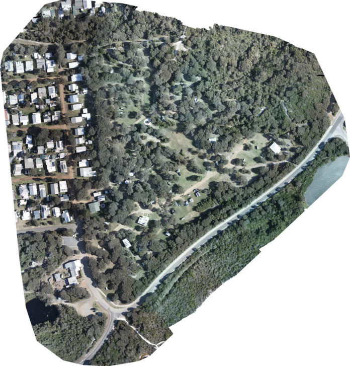
3-D Mapping with a drone involves taking a series of pictures of an area and stitching them together to create a series of useful data. The picture above is a collection of 540 images from 100m height of the Peaceful Bay caravan park.
We use dronedeploy for our mapping solutions across many fields.. https://www.dronedeploy.com/solutions/
Aerial Site Intelligence for Surveying & Construction
We create accurate, high-resolution drone maps, reports, 3D
models, and real-time 2D maps for any construction site
Mining and Quarries
Use aerial data to increase efficiency and accuracy
of stockpile management, inspections, and excavation
while keeping your team safe and compliant
Agriculture Professionals
Identify yield threats before setting foot in the field.
Available file formats:
| File Format | Notes |
|---|---|
| JPG (RGB Image) | Available for all 2D layers: 2D Map, Elevation, Digital Terrain Model and Plant Health. Includes a .KML file and a .TWF file with the georeferenced metadata. Easy to share through any standard image software such as Windows Photo Viewer or Preview. Print or use within presentations. Available in our Pro, Business, and Enterprise subscriptions. |
| __ | |
| GeoTIFF (RGB Image) | Available for all 2D layers: 2D Map, Elevation, Digital Terrain Model and Plant Health. Includes a .TWF file with the georeferenced metadata. Includes a .KML file is when using the Web Mercator Projection. File format suited for 2D analysis in GIS software such as ArcGIS or QGIS. * Available in our Pro, Business, and Enterprise subscriptions. |
| __ | |
| GeoTIFF (Raw Elevation Values – DEM) | Available for Elevation and Digital Terrain Model exports. One-band GeoTIFF file with embedded elevation values. File format suited for 2D analysis in GIS software such as ArcGIS or QGIS. Only available in our Business, and Enterprise subscriptions. |
| __ | |
| DXF/SHP (Contour files) | Available for Elevation and Digital Terrain Model exports. Georeferenced lines of equal elevation according to the chosen interval. See Contours. For use in AutoDesk suite and Mining/Construction software. Only available in our Business, and Enterprise subscriptions. |
| __ | |
| Shapefile (Contour files) | Available for Plant Health exports. Plant health data stored as a set of shapes (polygons) with a default resolution of ~10m x 10m (size depends on latitude). See Shapefile Exports. * Only available in our Business, and Enterprise subscriptions. |
| __ | |
| OBJ (3D Model) | Digital Model. .obj surface with .jpg texture files model. Not georeferenced: defined in a model-local coordinate system. * Available in our Pro, Business, and Enterprise subscriptions. |
| __ | |
| LAS (Point Cloud) | .las point cloud. Can be used in AutoCAD, ArcGIS, Global Mapper, Applied Imagery, or similar software. * Only available in our Business, and Enterprise subscriptions. |
| __ | |
| XYZ (Point Cloud) | .xyz point cloud that contains RGB information (XYZRGB). Resolution is specifiable. Most common file format accepted across Construction/Mining software formats. * Only available in our Business, and Enterprise subscriptions. |
| __ | |
| PDF Export | Available in our application natively. Able to export a PDF of 2D, Elevation, Digital Terrain Model and Plant Health layers. *Available on all paid subscriptions. |
| __ | |
| RCP File Export | AutoCad Specific File Only Available for our Enterprise Subscribers. *Easily import your export into AutoCAD |
| __ | |
| Source Imagery (ZIP) | Zip file containing the processed map’s source imagery Available to Enterprise Only *Can be combined with auto exports and supported integrations |


