Agriculture may be as old as civilization itself, but thanks to new technologies that make it easier to monitor crops and maximize yields, the industry remains on the cutting edge. In less than 15 minutes, advanced UAV technology can survey a 160-acre field to identify variations in plant soil and health, giving farmers direct access to real-time aerial views and data to help make informed agronomic decisions. The result is a full-scale drone operation that gives agronomists and contract seed growers the ability to make timely determinations that directly impact seed yields and quality.
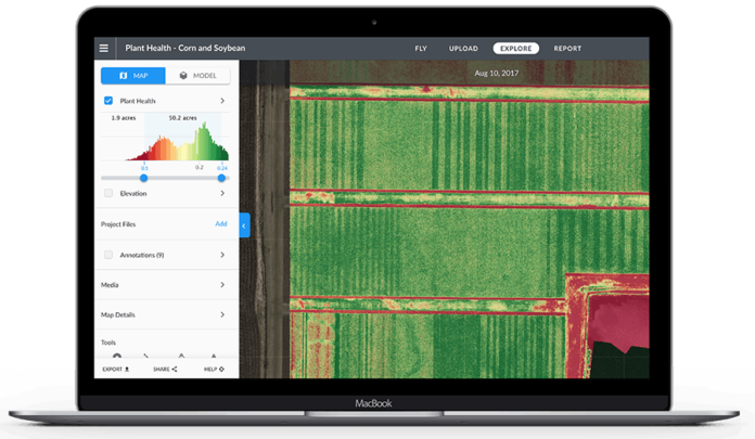
DroneDeploy’s Live Map giving real-time insights to plant health.
DroneDeploy’s Live Map technology provides real-time crop insights that enable growers to take immediate agronomic actions in the field. Whether it’s identifying an area that lacks irrigation or a particular crop that’s sprouting better (or worse) than expected, agricultural UAVs enable farmers to course correct issues through powerful, data-driven insights. Once drone fleets are ready to be deployed to field teams, drone operators undergo training to determine how to harness the power of aerial technology and ensure that operations adhere to local aviation regulations.
Utilizing UAVs developed by DJI, the collaboration between Corteva Agriscience and DroneDeploy brings some of the world’s most powerful agriscience solutions together with the world’s leading commercial drones and commercial drone software. Corteva Agriscience’s portfolio of products includes some of the world’s most recognizable brands in agriculture, including Pioneer, Brevant seeds, and Encirca and Granular, as well as Crop Protection products developed through active chemistry and technology.
DJI, the world leader in commercial and civilian drones, makes up more than 70% of the drone market and offers a wide variety of UAV products across many different industries. Combined with DroneDeploy’s user-friendly platform for real-time sharable drone maps and 3D models, farmers and agronomists across the globe will be able to carry out data-driven actions to keep fields full, healthy, and ready for seasons to come.
Where to Learn More
- Learn more about the improvements to the DroneDeploy Map Engine.
- Explore the DroneDeploy App Market to see more than 80 apps you can use today to generate insights with drone data.


